 InkDom
What “the real world” means here
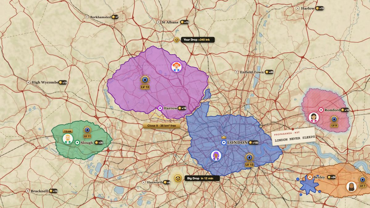
- Real towns. Every place of 1,000 people or more is on the map where it stands, from GeoNames: 8,401 cities and big cities, and a town about every 15 km on land. Each pays gold to the player who holds it.
- Real coasts. The sea is a wall. A peninsula can be closed with one line across its neck, and an island is as safe as its strait is wide.
- Real distances. Land is counted in km². Paris to Berlin is as far in the game as it is on the ground.
- Real roads and rivers. The war map draws the roads, railways and water of OpenStreetMap, so you can find your own street before you draw around it.
- One map. Everybody plays on the same Earth at the same time. Your neighbour in the game may be your neighbour.
Geography is the strategy
On a made-up map, every start is the same. On the real one, where you stand matters. A coast guards one side of your land for nothing. A strait is a gate that a line can hop and open sea is not. A big city pays the most gold, and for that very reason has the most rivals around it. Players who know their own region read the map faster than strangers do, which is a good reason to start at home.
“… I wanted to let you know how much I appreciate all the work you've put into InkDom, both as a player and as a cartographer. … If Season 3 is a work of art, season 4 is the Sistine Chapel. It is amazing. …”
How it plays
- Draw a loop. Press on your land, draw out and back with your pen, and let go. Everything inside turns your colour.
- Hold towns. Each real town pays gold every hour to whoever holds all of it.
- Grow your Ink Engine. Gold levels up the Engine that makes your ink, and ink draws the next loop.
Other players do the same, and they can loop around your land to take it. A season lasts 14 days. How to play has the whole game on one page.
Where the map comes from
| Part of the map | Source |
|---|---|
| Roads, railways, water, borders | OpenStreetMap contributors, via OpenFreeMap |
| Towns and their people | GeoNames (CC BY 4.0) |
| Land cover: forest, fields, built-up ground | ESA WorldCover (CC BY 4.0) |
| Hills and mountains | Mapzen Terrain Tiles |
Questions people ask
Is this like GeoGuessr?
No. GeoGuessr and the map quizzes are guessing games: you are shown a place and name it. InkDom is a strategy game. You take land on the map, defend it, and earn from the towns on it.
Does the game use Google Maps?
No. The map is drawn for the game from open data: OpenStreetMap, GeoNames, ESA WorldCover and Mapzen terrain.
Can I play on my own street?
Yes, your street is on the map. The pen is about 340 m wide, so you take a neighbourhood at a time, not a single house.
Do I need GPS, or to walk anywhere?
No. You play from your browser, wherever you are, and you can take land anywhere on Earth.
What other games use a real world map?
A few, in different ways. OpenFront plays quick matches on maps of real regions. Wplace lets everyone paint pixels on a world map. GeoGuessr is a guessing game on street photos. Turf is played by walking with GPS. InkDom is the one where the whole Earth is a single persistent strategy map.
Last updated 19 November 2026. InkDom is made by one person, Valentin. Something wrong or out of date? Say so in the game’s help chat or on Discord.